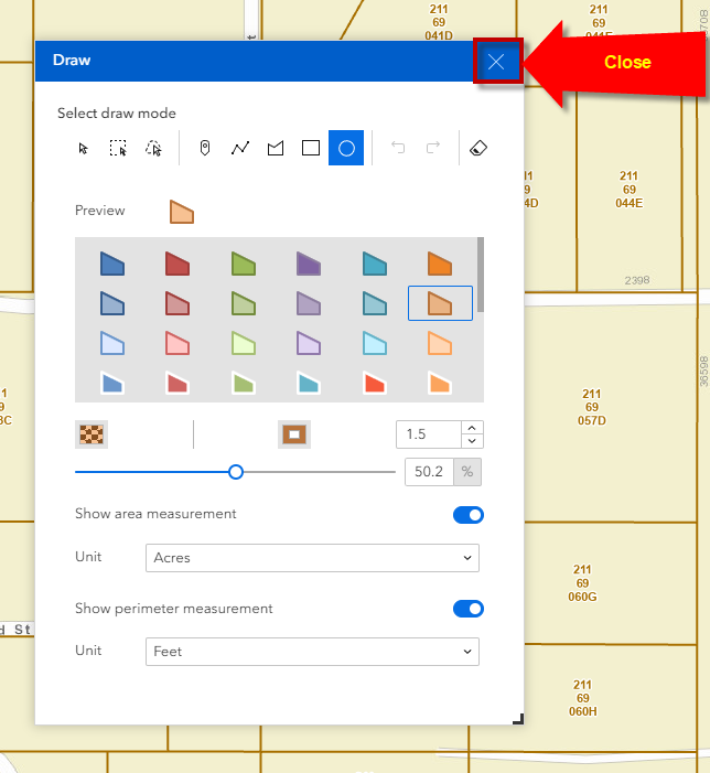
Draw Widget
Open the Draw Widget.
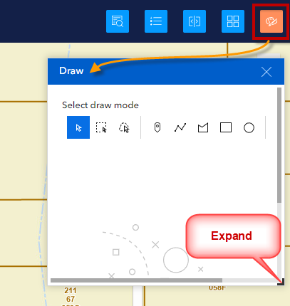
Expand the Draw Widget by dragging the handle on the lower right corner.
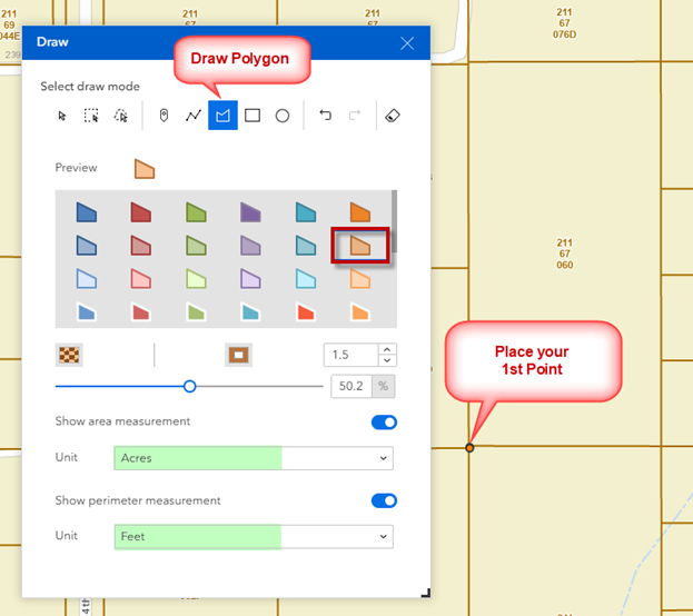
Select a drawing template from the list.
You can modify the Transparency and the Outline Width.
Set your Area Units to Acres.
Set your Linear Units to Feet.
Select the Draw Polygon Tool and place your 1st point on the map.
Place your 2nd point on the Map.
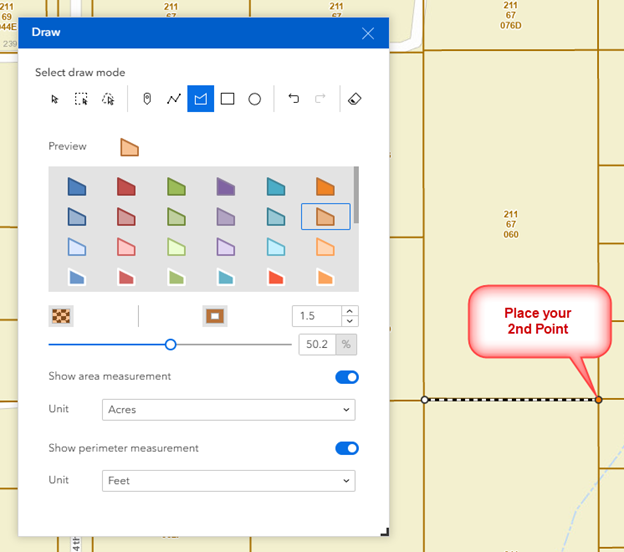
Place your 3rd point on the Map.
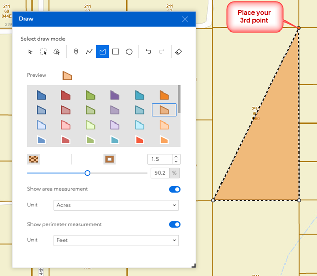
Move your mouse over the 4th point.
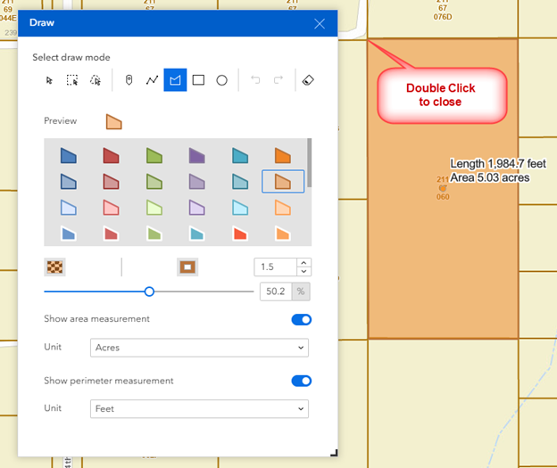
Double Click to close the polygon.
The Area of this polygon is 5.03 Acres.
The Perimeter of this polygon is 1984 feet.
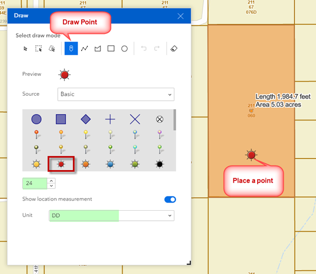
Select the Draw Point Tool.
Select a Point Symbol.
Set the size of the point symbol.
Set the Coordinates to Decimal Degrees (DD).
Place a point on the map.
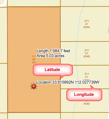
The Location is reported in DD with 6 decimal places.
Latitude = 33.815892 North
Longitude = 112.027739 West
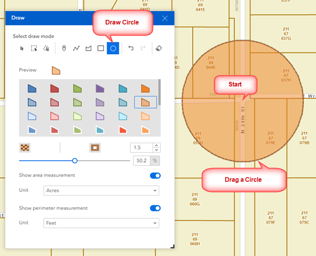
Select the Draw Circle Tool.
Drop a point at a Street Intersection to define the center of your circle.
Drag your mouse to expand the circle.
Let go of your mouse when you get the desired size.
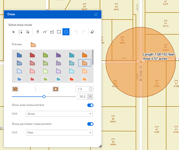
The Area of this circle is 4.57 Acres.
The Circumference is 1,581 Feet.
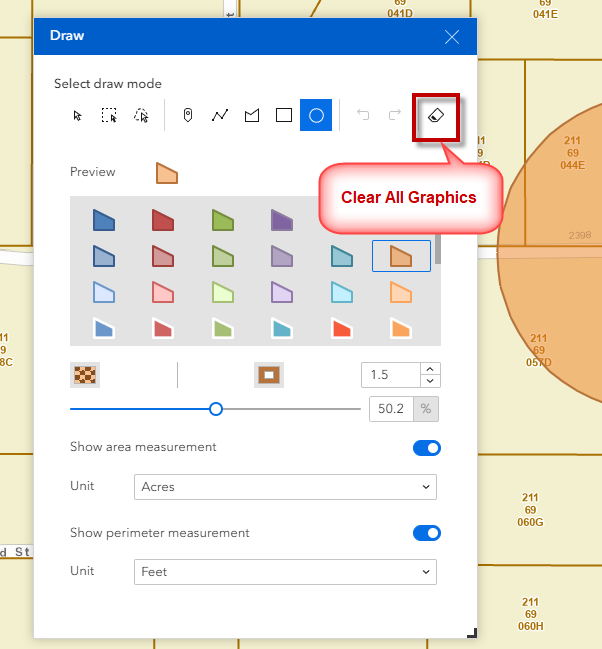
Clear all the graphics.
Close the Draw Widget.
