Near Me Widget
Open the Near Me Widget.
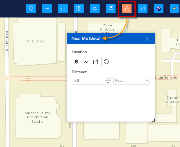
This widgets drills down the map layers and provides information on the closest feature found within your specified search distance.
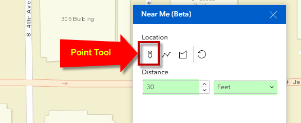
Set your Search Distance to 30 feet.
Select the Point Tool.
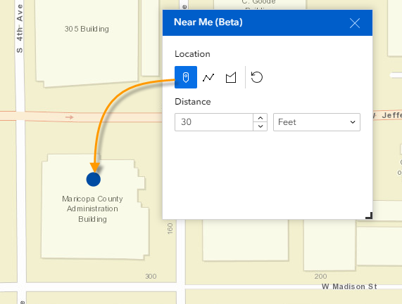
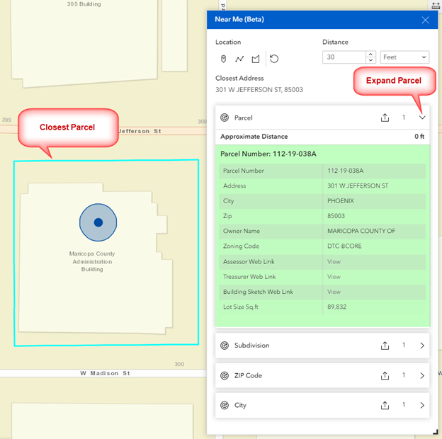
Drop a point over the Maricopa County Admin Building.
It finds the closest address as 301 W JEFFERSON ST, 85003.
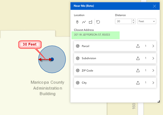
The widget reports the closest Parcel, Subdivision, ZIP Code and City.
Expand Parcel to see the attributes.
The closest parcel boundary is highlighted in cyan.
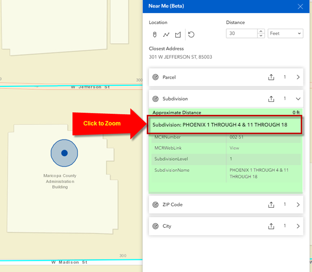
Expand Subdivison.
This Parcel is a part of Subdivision = PHOENIX 1 THROUGH 4 & 11 THROUGH 18
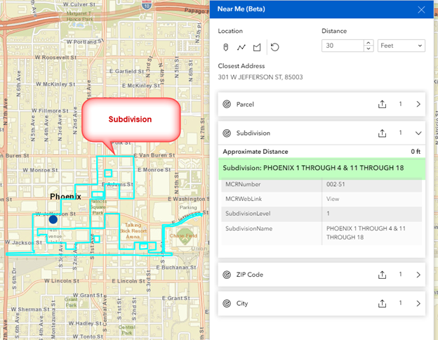
Click on this Subdivision Name to zoom to it.
The Subdivision boundary is highlighted in cyan.
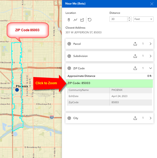
Expand ZIP Code.
The point you entered falls within ZIP Code 85003.
Click to Zoom.
Expand City.
Your point falls within the City of Phoenix.
Click to Zoom.
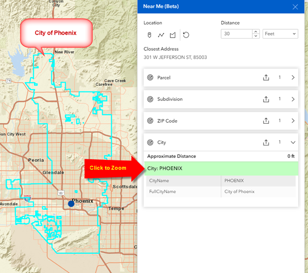
Summary:
Your point falls within Parcel 112-19-038A, which is a part of Subdivision PHOENIX 1 THROUGH 4 & 11 THROUGH 18, which is part of ZIP Code 85003, which is part of the City of Phoenix.
Note: The Near Me Widget will only report the nearest feature.
It will not report other features which may happen to fall within the search radius.
To understand this concept, click on the Parcel Number.
The map will zoom to Parcel 112-19-038A
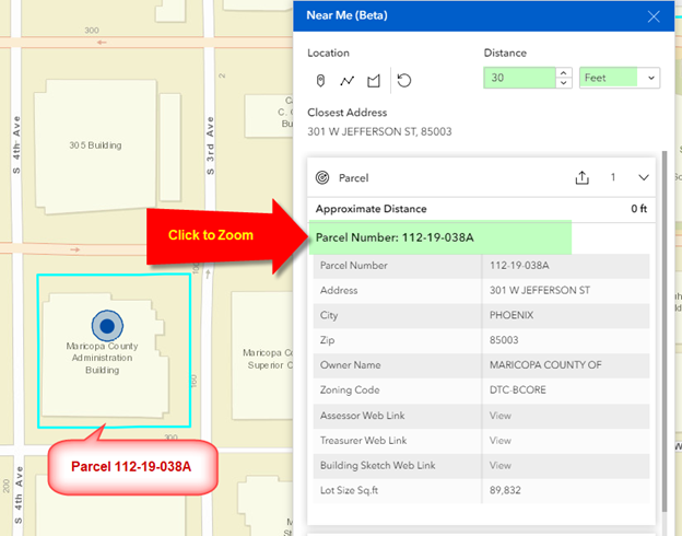
Notice that the search radius is 30 feet.
Turn on the Parcel Layer.
Expand the search radius to 300 feet.
The blue buffer expands to 300 feet around your input point.
There are many parcels that fall within this buffer zone.
However, the Near Me Widget will only report the closest parcel found, which is 112-19-038A.
It will ignore the other parcels that are within 300 feet of your input point.
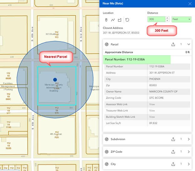
If you want to find all parcels that fall within 300 feet of your input point, you will have to use the Spatial Search function within the Query Widget that you will learn about later.