Print Widget
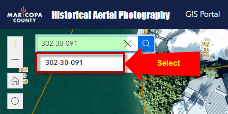
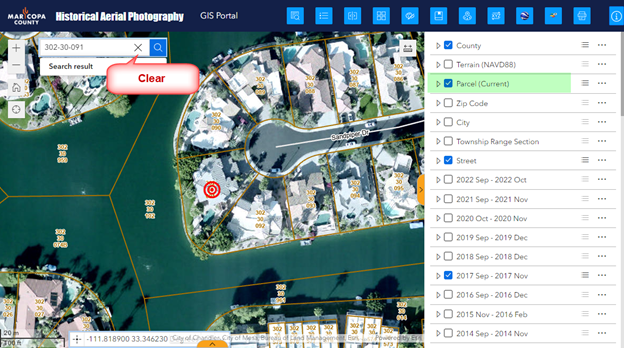
Zoom to your area of interest by entering a Street Address, Cross Street or Parcel Number in the Search Tool.
Example Parcel Number = 302-30-091
Turn off the 2022 Aerials.
Turn on the 2017 Aerials.
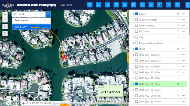
Zoom in closer.
Turn on the Parcel Layer.
Clear the result in the Search Tool if you wish to remove the red target symbol.
Collapse the right Sidebar.
Open the Print Widget.
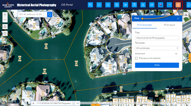
The default Print Template = A3 Landscape
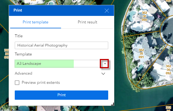
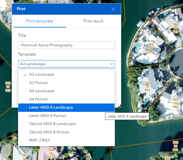
First, change the default Print Template = Letter ANSI A Landscape
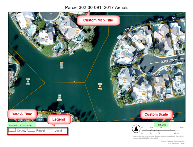
Next, add your Custom Map Title = Parcel 302-30-091, 2017 Aerials
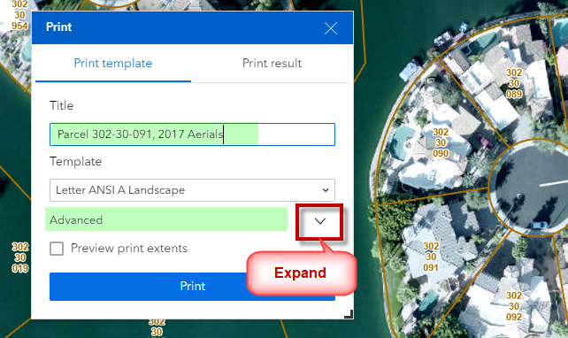
Expand the Advanced Options.
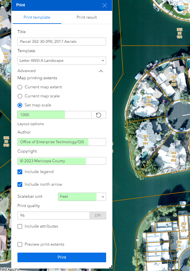
Set Map Scale = 1000
Your map will print at a Custom Map Scale of 1:1000
Author = Office of Enterprise Technology/GIS
Copyright = © 2023 Maricopa County
Check the option to include the map legend.
Check the option to include the north arrow.
Change the Scalebar unit to Feet.
Leave the Print Quality at 96 dpi. Do not alter this!
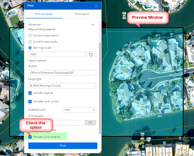
Check the option to Preview print extents.
A preview window with a black border will appear showing you the actual printing area.
Press Print
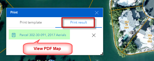
Open the Print Result Tab and view the PDF Map that got generated.
