Swipe Widget
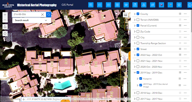
The Swipe Widget offers an elegant way to compare the most recent Aerial Imagery against previous years dating all the way back to 1930.
Refresh the Web App.
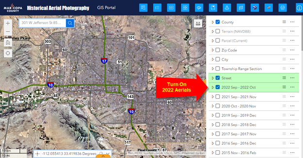
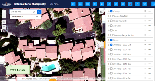
Make sure the Street Layer and the 2022 Aerials are turned on.
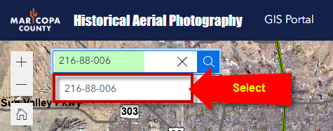
Enter Parcel Number 216-88-006 in the Search Tool.
The map zooms to Parcel 216-88-006.
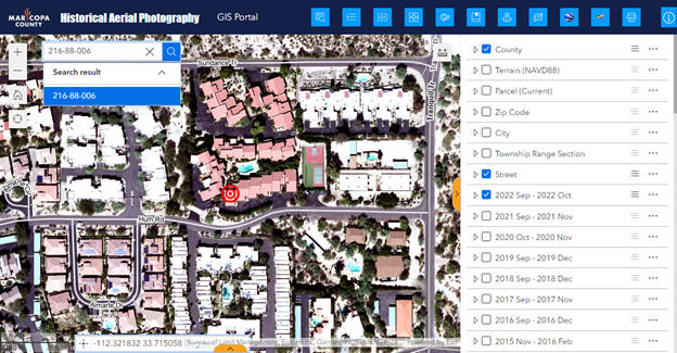
Zoom in closer.
You are viewing the 2022 Aerials.
Open the Swipe Widget.
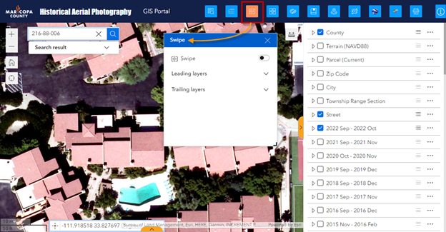
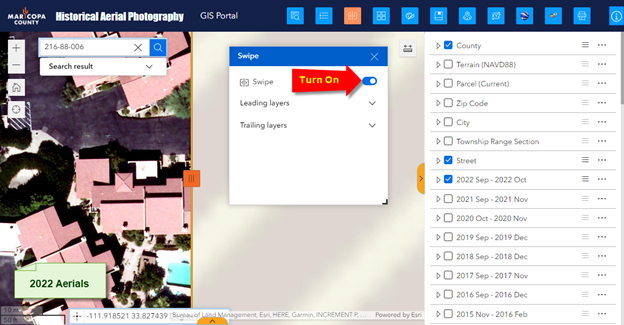
Activate the Swipe Tool.
The 2022 Aerials will appear on the left half.
The right half will be empty.
Turn on the 2021 Aerials.
The 2021 Aerials will appear on the right half.
Close the Swipe Widget to get it out of the way but do not close the Swipe Tool.
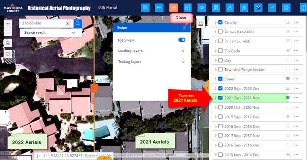
Drag the Swipe Handle horizontally to compare the 2022 Aerials against the 2021 Aerials.
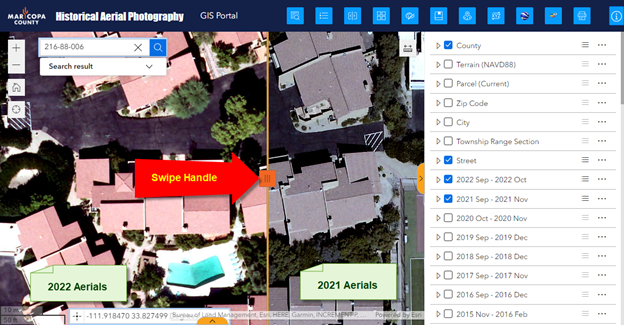
Turn off the 2021 Aerials.
Turn on the 2020 Aerials.
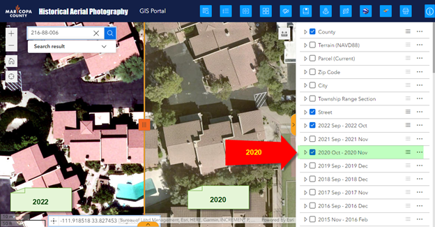
Turn off the 2020 Aerials.
Turn on the 2019 Aerials.
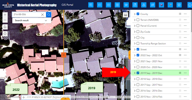
Expand the 2019 Aerial Imagery Group.
Turn on the Footprint Layer.
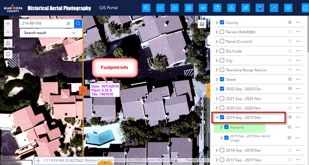
Turn on the Parcel Layer.
The Parcel Boundaries will appear on the right half.
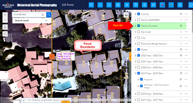
Open the Swipe Widget.
Expand the Trailing Layers.
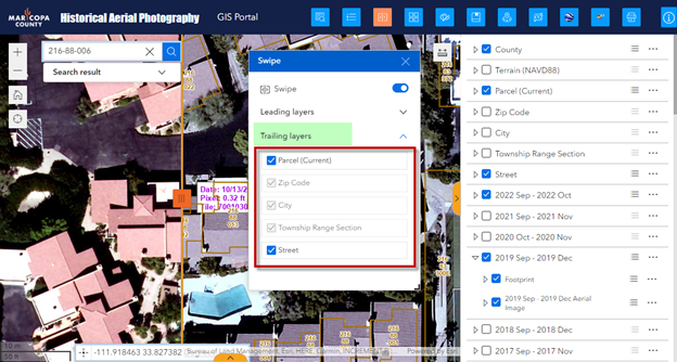
Uncheck Parcel.
The Parcel Boundaries will now appear on the left as well.
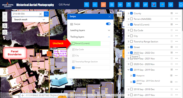
Deactivate the Swipe Tool.
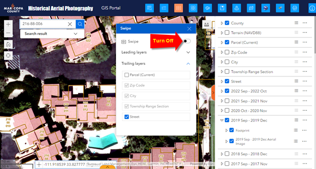
Close the Swipe Widget.
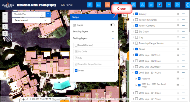
Note: You could also click on the Swipe Widget Icon to close the Swipe Widget.
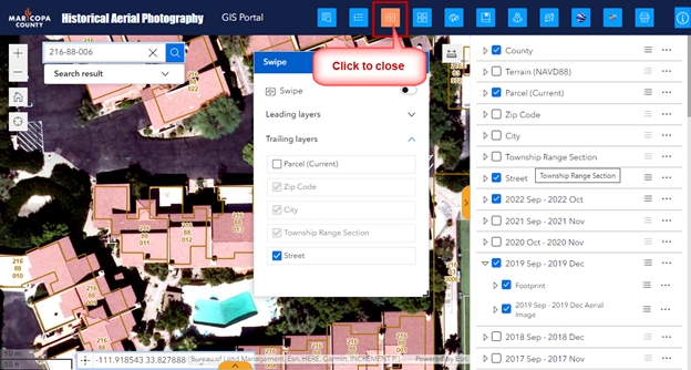
Clicking on any Widget Icon opens it. It turns orange.
Clicking on the Widget Icon a second time closes it.
