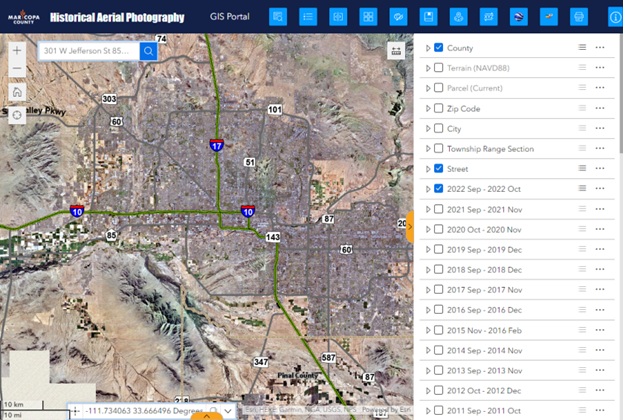
Welcome to the new Maricopa County Historical Aerial Photography Web Application.
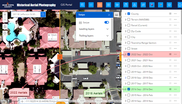
This Web Application offers a simple interface to zoom to your area of interest and compare the latest Aerial Images with those taken one, two, five, ten years dating all the way back to 1930.
They present a fascinating visual history of how Maricopa County grew from a small population of less than a million in 1970 to become the 4th largest County in the US serving a population of 4.6 million.
In addition to these Ortho Aerials, you can view the high-resolution oblique imagery from Pictometry and explore your study area in 2D and 3D using Google Maps and Google Street View.
This web app includes the entire 1.7 million Parcel Database of Maricopa County with links to the Maricopa County Assessor, Treasurer and Recorder web pages.
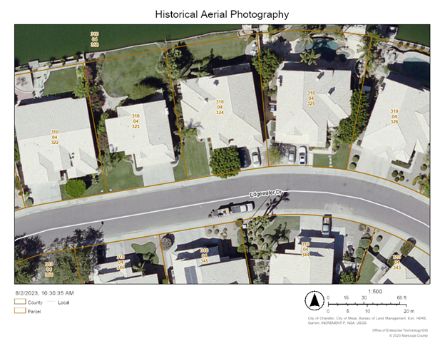
You can print a professional quality PDF map of your study area with a custom title, map scale, author, copyright information, map legend and north arrow.
This Web Application was created using the ArcGIS Experience Builder, the next generation Web Mapping platform from ESRI.
This User Guide will walk you through all the Widgets and Tools with short examples to get you familiar with all the capabilities of this feature rich web application.