Launch the Historical Aerial Photography Web App.
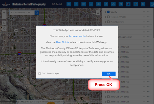
Press OK to close the Splash Screen.
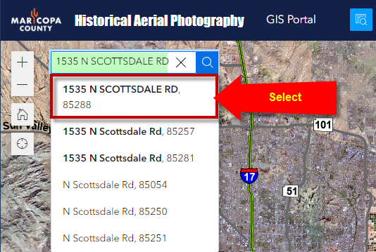
Enter a Street Address with a Zip Code in the Search Tool.
Example: 1535 N SCOTTSDALE RD 85288
Note: The case does not matter.
You may leave out the Zip Code.
Select 1535 N SCOTTSDALE RD, 85288 from the list of best matches that are found.
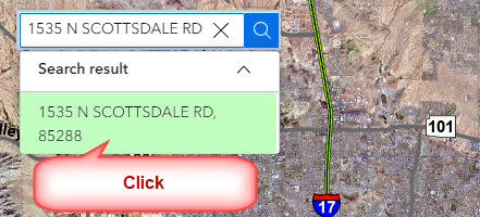
Click on the Search Result.
The map will zoom to this address.
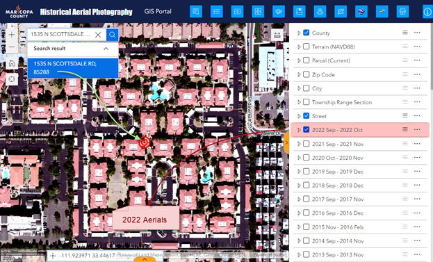
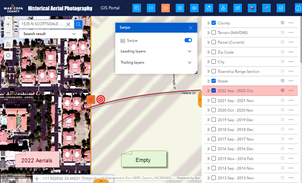
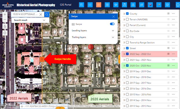
You are viewing the 2022 Aerials.
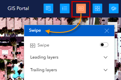
Open the Swipe Widget.
Activate the Swipe Tool.
This will split the screen horizontally.
The 2022 Aerials will appear on the left.
The right side will remain empty.
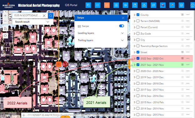
Turn on the 2021 Aerials from the Map Layer List.
The 2021 Aerials will appear on the right.
Next, you are going to compare the 2020 Aerials with the 2022 Aerials.
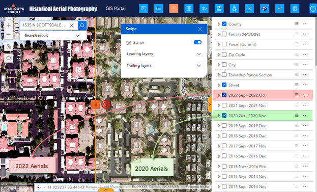
Turn off the 2021 Aerials.
Turn on the 2020 Aerials.
The 2020 Aerials will appear on the right.
Zoom in closer.
You can slide the Swipe Handle to swipe between the 2022 Aerials on the left and the 2020 Aerials on the right.
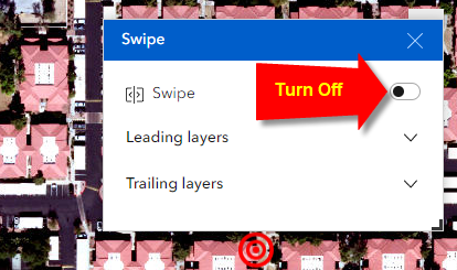
Deactivate the Swipe Tool.
Close the Swipe Widget.
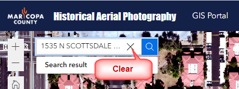
Clear the Search Tool.
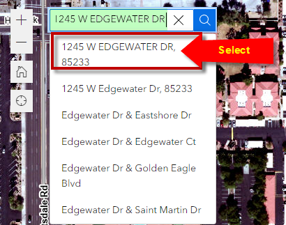
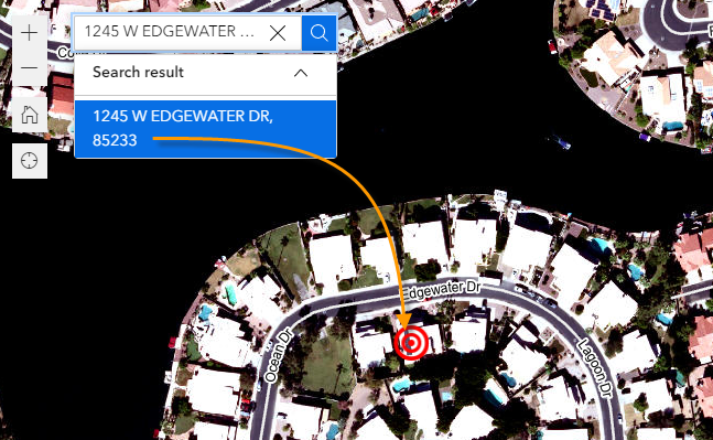
Enter a new Street Address = 1245 W EDGEWATER DR 85233
Select 1245 W EDGEWATER DR, 85233 from the drop-down list of choices.
Click on the Search result.
The map will zoom to this address.
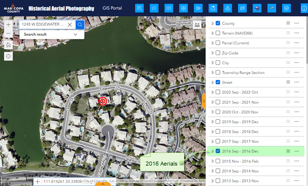
Zoom out.
Turn off the 2022 Aerials.
Turn on the 2016 Aerials.
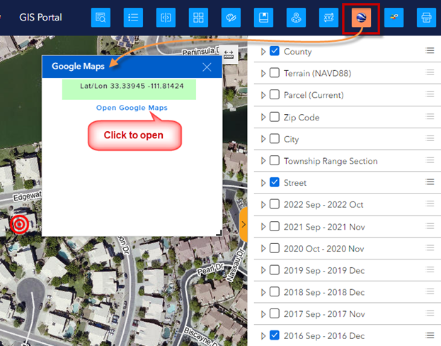
Open the Google Maps Widget.
Move your cursor around the map till you see a Lat/Lon readout.
Click to open the Google Maps Link.
This will launch a separate Google Maps Window.
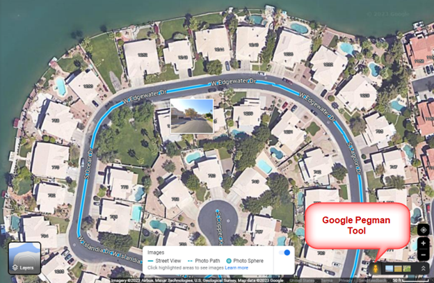
Activate the Google Pegman Tool.
All the streets where Google Street View information is available will be highlighted in blue.
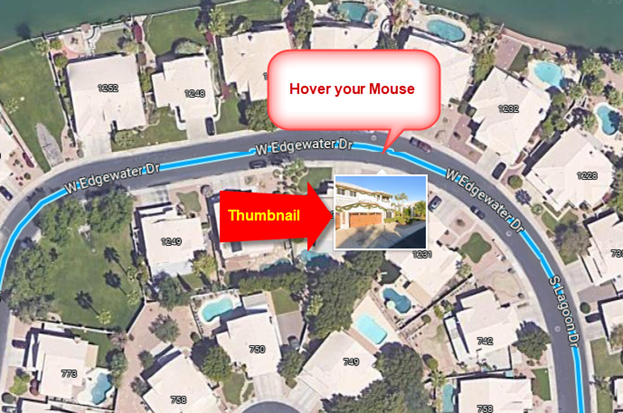
Hover your mouse over any blue segment.
A thumbnail will appear.
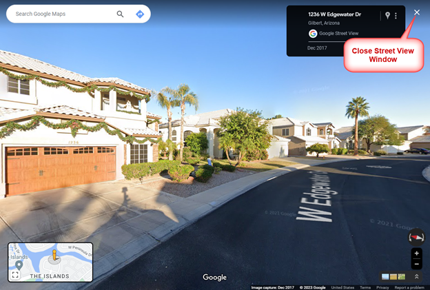
Click on any blue segment.
This will launch Google Street View.
Close the Google Street View Window.
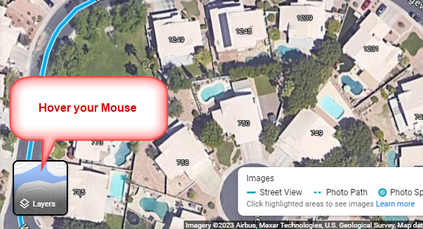
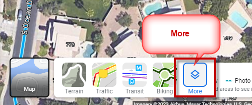
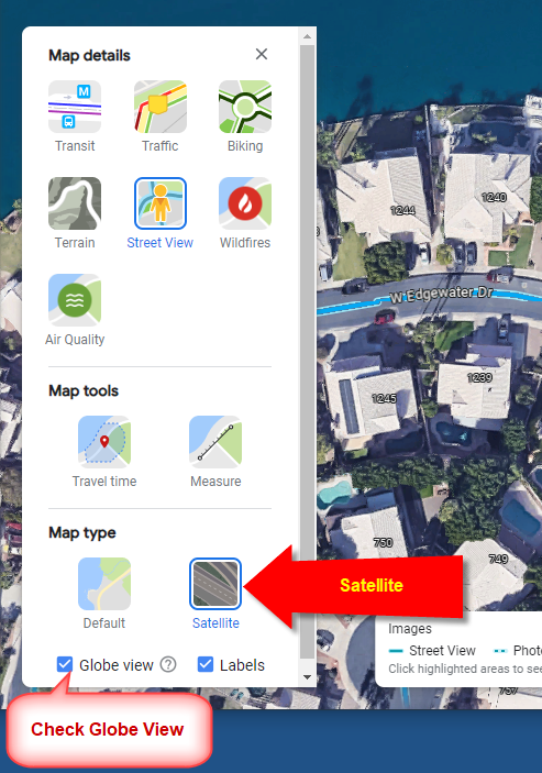
Hover your mouse over Map Layers.
Select More Layers.
Check Globe View.
Turn on Satellite Imagery.
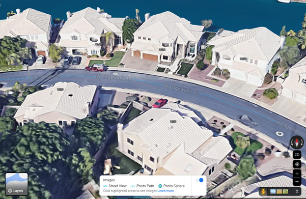
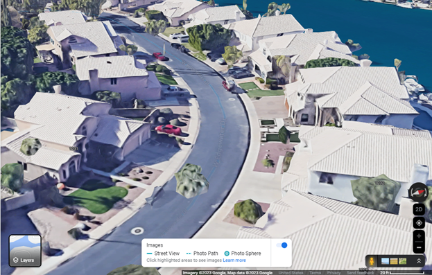
You are now ready to experience your world in 3D.
Hold down your Control Key while dragging your mouse.
To change the Tilt, drag your mouse vertically while holding down the Control Key.
To change the Rotation, drag your mouse horizontally while holding down the Control Key.
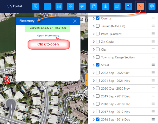
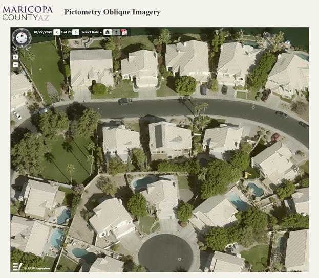
Open the Pictometry Widget.
Move your mouse over the map till you see a Lat/Lon readout.
Click on the link to open a separate Pictometry Window.
Next, you are going to print a professional quality PDF Map.
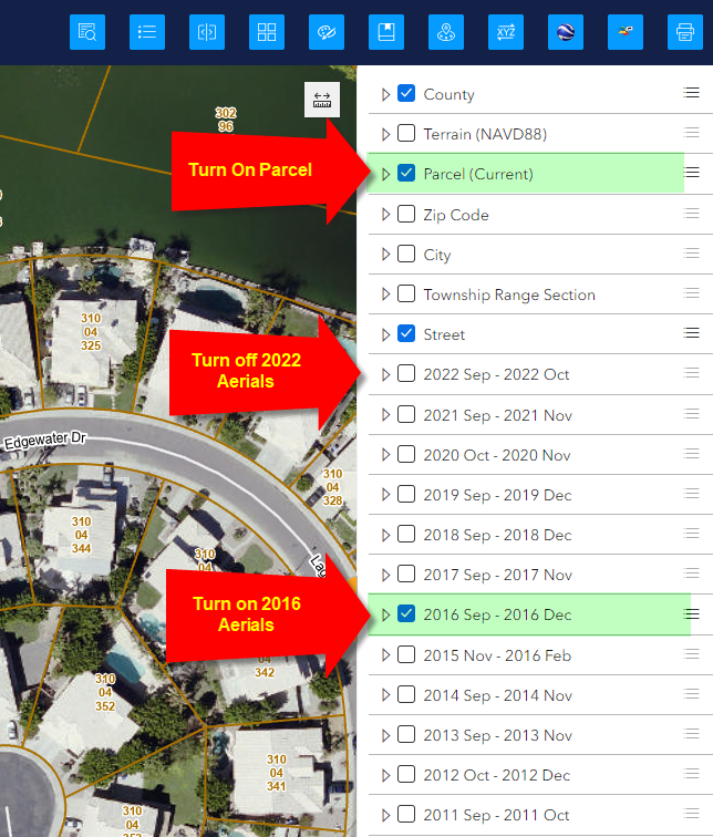
Turn on the Parcel Layer.
Make sure the 2022 Aerials are off.
Make sure the 2016 Aerials are on.
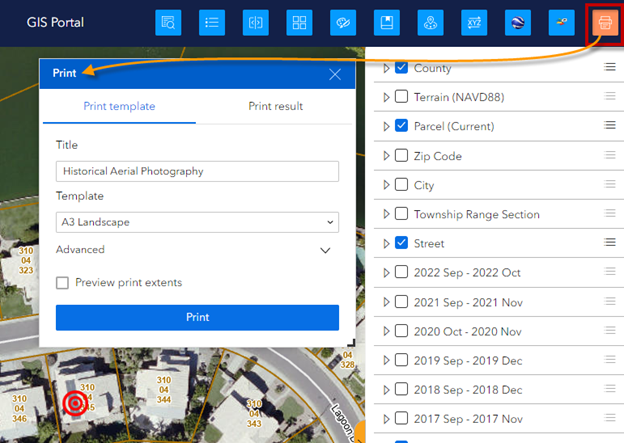
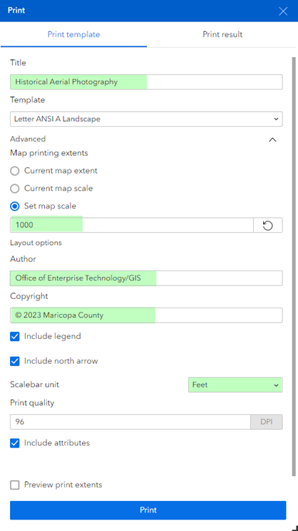
Open the Print Widget.
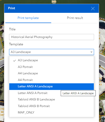
Select Template = Letter ANSI A Landscape
Set your advanced options:
Press Print
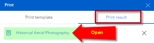
Open the Print Result Tab.
Open the PDF Map.
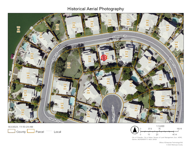
This is your PDF Map.
This completes your Quick Tour.
Please go through the remainder of this User Guide to learn how to use each Widget and their functionality.